View_02_final-1-1
In Planning

Energy Storage System

Legacy ESS

0,0
Homes Powered
0MW
Capacity
0.0
Hectares of Land

Introduction

We are proposing a 400 megawatt (MW) ESS to be located on land north of Bronwylfa road, Rhostyllen, Wrexham. The development site covers approximately 5.5 hectares, and is located in fields to the east of the Legacy National Grid substation and west of the A483.

We used feedback received during Pre Application Consultation to finalise the planning application, which has now been submitted to Wrexham County Borough Council. The application can be viewed on the council website with the planning reference number P/2024/0155.

We held a community consultation event at The Rhostyllen Parish Hall, Wrexham, LL14 4AR on Thursday 11th May 2023. The information boards shown at the event are available in the Project Resources section at the end of this page. The site design has been amended following public consultation and the development area reduced by 64%. 

Why do we want to develop here?

The UK has a legally binding target to achieve Net Zero by 2050 and has committed to fully decarbonising the electricity network by 2030. As a result, many low carbon and renewable energy generation is needed across the UK. Renewable energy generation is however intermittent, and Energy Storage Systems are therefore required to provide a balancing service to the National Grid, facilitating the transition to renewable energy sources. These projects are therefore a crucial component of achieving Net Zero.

The site has been carefully selected and designed through a detailed assessment process considering heritage, landscape, ecological and environmental designations, access, flooding, transport and agricultural land quality. We have engaged a team of expert consultants to provide advice on the project.

We sought pre-application advice from Wrexham County Borough Council and have completed statutory Pre Application Consultation, with both consultations having informed the site design and planning application.

Environmental Benefits

The UK has a legally binding target to achieve Net Zero by 2050 and has committed to fully decarbonising the electricity network by 2035.

The Welsh Government has already set an ambitious target for Wales to meet 70% of it’s electricity demand from Welsh renewable sources by 2030 and are consulting to push further o meet 100% of its electricity needs from renewable sources by 2030.

As a result, many low carbon and renewable developments are needed across the UK. Renewable energy generation is intermittent and Energy Storage Systems help to balance this by storing electricity at times of low demand and releasing this at peak demand. This allows us to make better use of our existing electricity supplies and for electricity generated from renewable energy sources to be fully utilised.

There will be a significant increase in demand for electricity in the coming years as more sectors (such as cars, heating, road fleet and trains) rely more extensively on electricity as a fuel source.

The Future Energy Scenarios 2022 report (written by National Grid ESO) indicates that the UK will need more than 250GW of energy storage by 2050 and this proposal would add a significant amount of energy storage to this pipeline.

In April 2022, Renewable UK reported that, nationwide, there was around 1.5GW of energy storage in operation, 1.5GW under construction, and 10GW that had consent, but had not yet been built. A significant increase is required in order to meet the projected requirements.

overlay

Current planning process status

01

Complete

Community Consultation Event

We held a community consultation event at The Rhostyllen Parish Hall, Wrexham, LL14 4AR on Thursday 11th May 2023.

02

Complete

Pre Application Consultation

We sought pre-application advice from Wrexham County Borough Council and have completed statutory Pre Application Consultation,

03

Complete

Application Submission

The planning application has now been submitted to Wrexham County Borough Council. The application can be viewed on the council website with the planning reference number P/2024/0155.

04

TBC

Decision on Application

Information regarding the decision on our planning application will be shared here in due course.

ESS-render-1

The Location

Site Design

The site has been carefully selected and the design informed by a detailed assessment process.

We undertook a Site Selection Assessment which sought to identify an optimum site of the requisite size within a 2.5km study area from the Legacy National Grid substation. A total of 29 locations were initially identified and, when these sites were assessed against a set of key criteria. The site now identified for development was classified as the most suitable

The proposal will be connected to the nearby Legacy National Grid substation via an underground cable.

It is proposed that access to the development will be from an existing field access on Bronwylfa Road and a new access created from the lane on the sites western boundary. Internal access tracks will be created within the development site around the ESS containers and to the substation.

The energy storage containers are distributed through the site in pairs, with each pair having separately housed power conversion equipment (MV Skid). Groups of ESS units will then connect into a transformer bay that feeds into the on-site substation.”

The existing public right of way crossing the site has been retained, with new planting and bunding to the west.

Following community consultation we made several changes to the proposals including:

  • Reducing development area by 64%;
  • Providing additional screening along the western and southern boundaries by way of woodland tree planting and bunding;
  • Introducing a permissive footpath into the scheme to enhance the pedestrian connectivity between Rhostyllen and Bersham Cricket Club; and
  • Reducing the height of the tallest infrstructure

If approved, the development would have an operational period of 50 years, needing only occasional maintenance. At the end of this period the development would be decommissioned, all equipment removed, and the land restored to agricultural use.

Site Access

The primary construction access will be from the existing access on the B5097, with a secondary access from Cadwgan Lane on the sites western boundary.

The number of construction vehicles that will be required has been forecast and is included in the Construction Traffic Management Plan submitted as part of the planning application. There will be several abnormal load movements during the construction period, and we have completed an assessment to ensure these vehicles can safely access the site

Operational Phase

Once operational the site would be visited for occasional routine maintenance. Typically, this would involve a light goods vehicle with one or two site operatives, who would access the site and carry out routine maintenance checks on the installed equipment.

In the first five years post construction, there would also be regular visits by landscape contractors to monitor and manage completed landscape works like newly planted trees, during the initial establishment phase. Similarly, ecologists would visit the site to monitor and manage new habitat creation.

Specialist Surveys

We have instructed a range of specialist consultants who have completed surveys and assessments to inform the site design and planning application.

Landscape and Visual

We have completed a full Landscape and Visual Impact Assessment (LVIA) which will accompany the planning application. Key viewpoints from the surrounding area have been assessed within this LVIA.

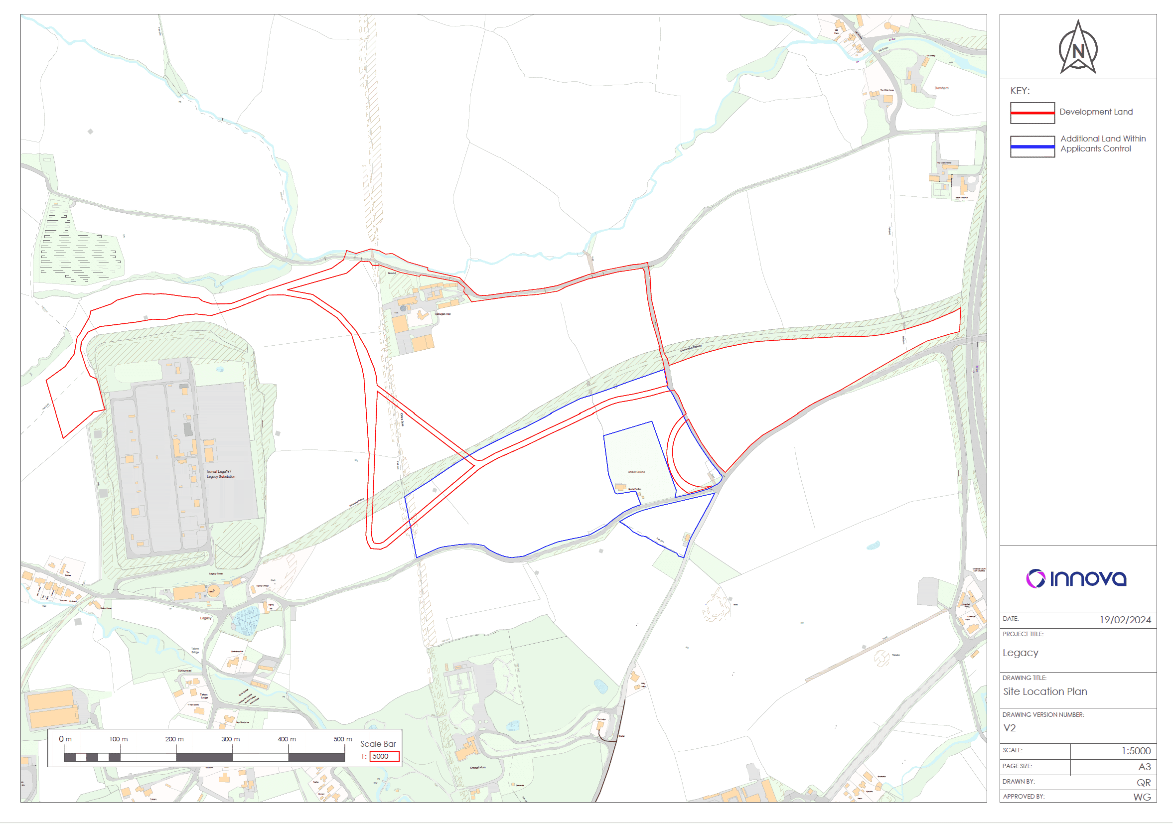
The site is not in a National Park, AONB or Special Landscape Area and is approximately 1.8km east of the Clwydian Range and Dee Valley AONB at its closest point.

The LVIA concludes that any notable effects on landscape character and visual amenity as a result of the proposed development would be localised and would be reduced by proposed mounding and woodland planting, which would provide increased filtering and screening of the proposed development overtime as planting matures.

Agricultural Land Quality

An agricultural land classification survey has been completed which confirms the development site comprises Grade 2 agricultural land. In planning policy terms, ‘Best and Most Versatile’ agricultural land (which is afforded the highest level of protection) comprises Grades 1, 2 and 3a. Lower grade agricultural land comprises land that falls in Grade 3b, 4 and 5. Previous surveys of this general area of Wrexham have shown higher grade land is common.

Cultural Heritage and Archaeology

Our archaeology consultants have liaised with Clywd-Powys Archaeological Trust (CPAT). An Archaeological Desk Based Assessment has been completed which considers the proposal and the cable route options in the context of designated heritage assets, such as nearby Offa’s Dyke, as well as the potential for sub-surface non-designated assets.

Following the desk-based assessment and upon recommendation of CPAT, a geophysical survey of the site was completed. This was followed by archaeological trial trenching, which concluded that the archaeological potential of the proposed development site.

Whilst the exact cable route between the energy storage units and Legacy substation has not yet been determined, we have liaised with Cadw and completed further surveys to identify suitable sections to cross Offa’s Dyke with a cable, should it be required.

A Settings Assessment and Heritage Impact Assessment has been completed to determine the potential for any effects on any above ground heritage assets within 3km of the site. With appropriate mitigation, such as screening, sensitive site design and considered planning of the cable route, the potential impact of the development on nearby above ground heritage assets will be minor to moderate.”

Biodiversity Net Gain (BNG)

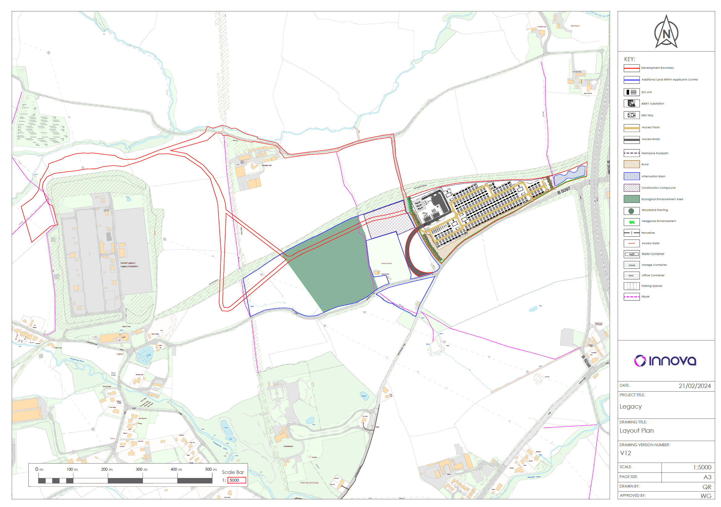
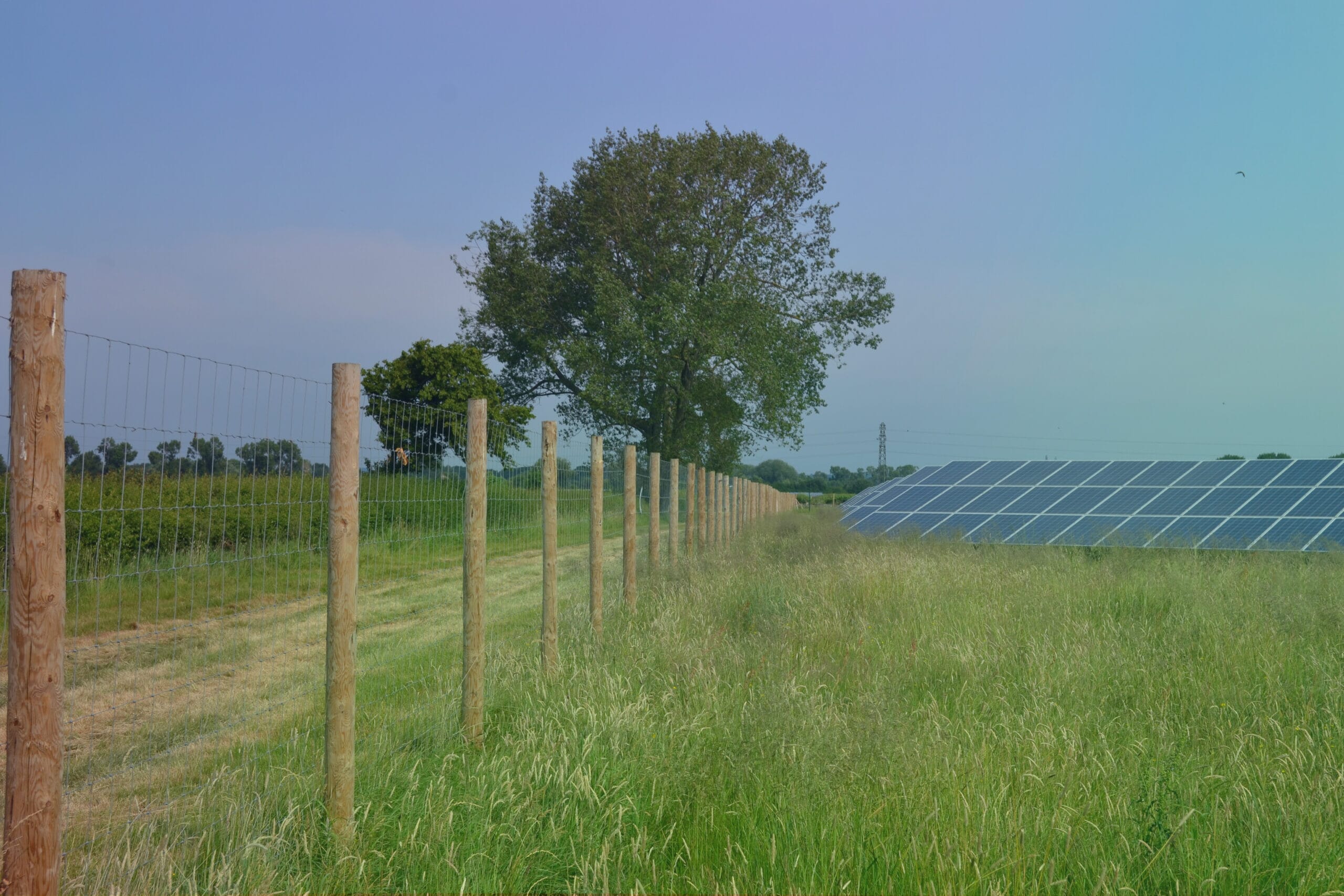
The scheme will deliver a significant Net Benefit for Biodiversity. This will primarily be achieved through the enhancement of 4.5ha of land to the west of the site to benefit bats, birds, invertebrates, grassland habitat and riparian habitat. The land will be brought into long-term conservation management which will ensure a sustainable future for this area and the flora and fauna that it supports. There will also be new planting and enhancement of existing hedgerows on the main development site.

Hydrology

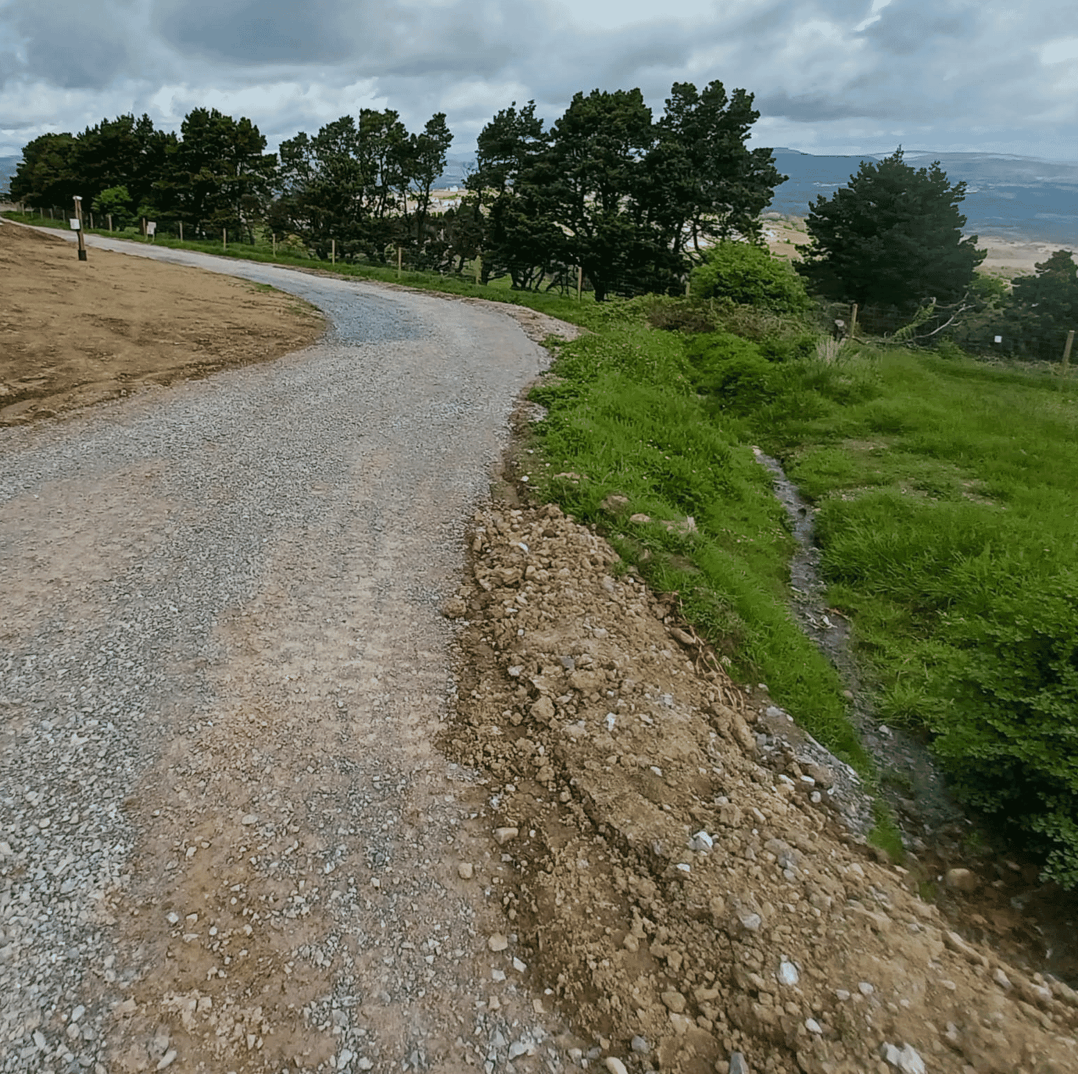
The site is located within Flood Zone 1, meaning it has less than a 1 in 1000 chance of flooding in any given year, including climate change. Pre-application advice was sought from the Sustainable Drainage System Approving Body, and a Flood Risk Statement and Outline Drainage Strategy included in the planning application. The drainage strategy uses sustainable drainage system principles to ensure that the proposals do not increase flood risk on or off the site.

Noise

The planning application is supported by a Full Noise Impact Assessment which has identified the closest noise receptors and considers the potential noise generation from the proposed development, in the context of existing sound levels in the area. Several noise mitigation measures have been included in the design.