5-1
Pre-Construction

Solar

Welsh Way Solar Farm

Introduction

Innova Renewables Developments have secured planning permission from Cotswold District Council for a solar farm on land adjacent to Welsh Way, near Fairford. The site covers 19.8ha of land, provides positive environmental impacts and will generate enough electricity to power approximately 2,400 households in 2026


Why do we want to develop here?

The UK has committed to becoming Net Zero by 2050 and a target to decarbonise the electricity grid by 2030. Welsh Way Solar Farm would support the UK’s transition to Net Zero and increase the use of renewable energy through supporting the availability of energy to the National Grid.

Environmental Benefits

There is widespread awareness of the need to reduce dependence on fossil fuels and an encouragement to increase the generation and use of renewable energy.

In June 2019, Cotswold District Council declared a climate emergency. The Council is committed to meeting the target of making the Council and the district as a whole carbon neutral by 2030.

The Cotswold District Council Emergency Strategy 2020-2030 (2020) highlights the Council’s target of making their activities net zero of all greenhouse gasses as soon as possible, aiming for an 80% reduction in CO2 against the 1994 baseline by 2030 and a 100% reduction by 2045.

The UK has committed to becoming Net Zero by 2050 and a target to decarbonise the electricity grid by 2030. This requires an extra 3GW of solar to be built each year. The Powering Up Britain (published in March 2023) sets an ambition to increase the use of solar fivefold by 2030, therefore renewable energy developments like the Welsh Way Solar Farm are a key part of addressing the local and national climate emergency.

overlay

Current planning process status

01

Completed

Community Consultation Event

Our community consultation event has been completed.

02

Completed

Revise Proposals

Revised Proposals have been completed.

03

Completed

Application Submitted

We have now submitted a planning application to Cotswold District Council.

04

Approved

Decision on Application

We have been granted planning permission from Cotswold District Council

Rectangle-1-4

Site Design

The site has been carefully selected and designed during a detailed assessment process considering land and grid availability, solar irradiance, access, landscape and amenity, agricultural land quality, ecology, heritage, and environmental designations. We have engaged a team of expert consultants to undertake site specific assessments which are now complete.

The selected site benefits from existing tree and hedgerow planting along the field boundaries, with The Down’s and Paton’s Plantations to the north of the site providing further screening. To ensure the development is suitably screened, additional planting is proposed to strengthen the existing field boundaries. This will be demonstrated in a detailed planting plan as part of the planning application.

The grassland underneath the panels will be suitable for sheep grazing. The margins of the site outside the fence line can be used for other habitat enhancements such as wildflower seeding which will boost the biodiversity.

Site Access

The proposal includes a single point of access via an existing access on Welsh Way. The planning application was supported by a Constructed Traffic Management Plan, which includes a suite of measures to ensure the access operates safely and that the effect of construction vehicle movements on the local highway network is reduced.

The operational access will also utilise the same access located on Welsh Way. There will be minimal traffic during the operational period, with a site visit required approximately once a month for maintenance purposes. Occasional trips would also be made to the site as part of our ongoing planning and environmental management compliance checks.

Specialist Environmental Surveys

Specialist consultants completed a range of surveys that informed the design and were submitted with the planning application:

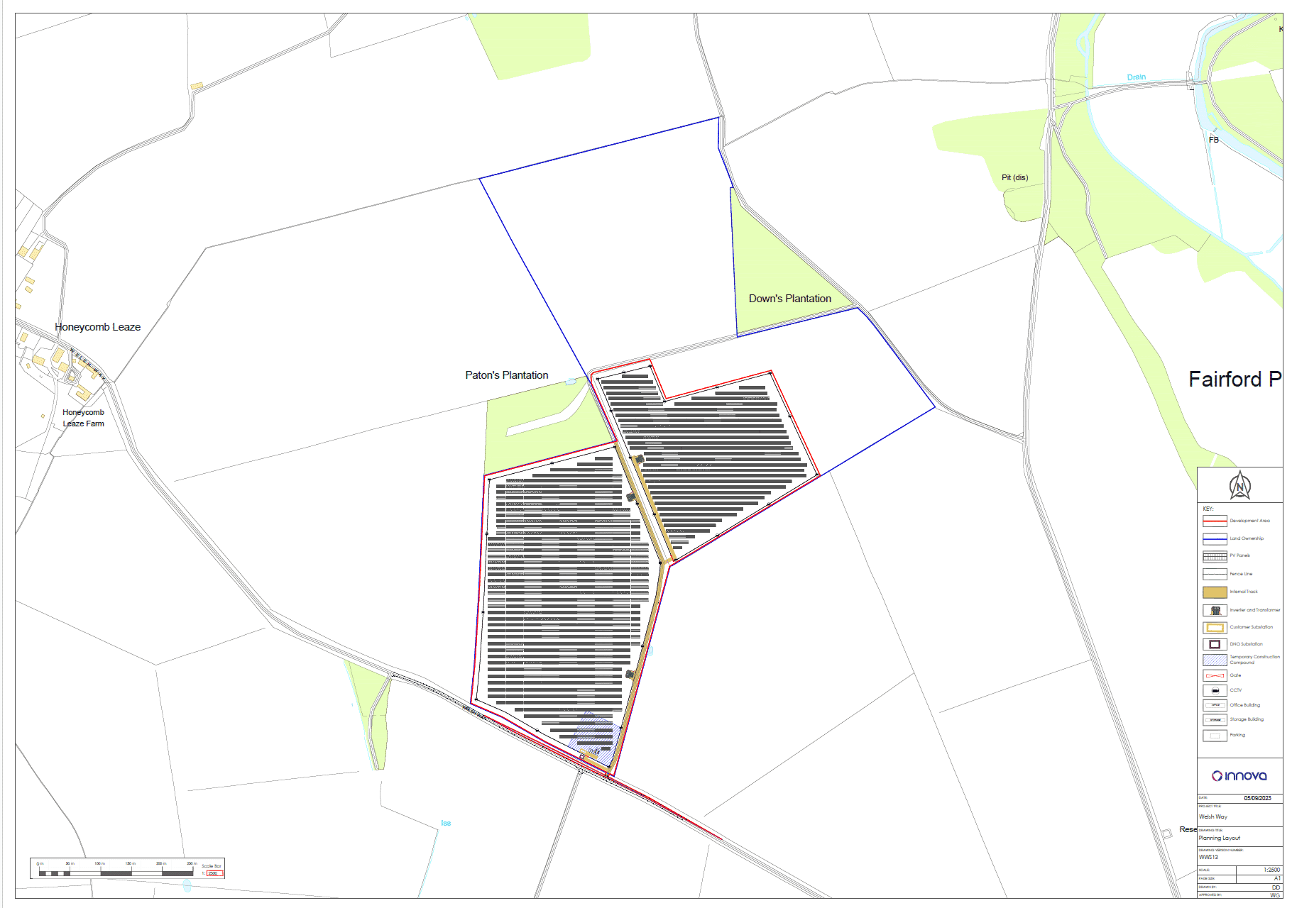
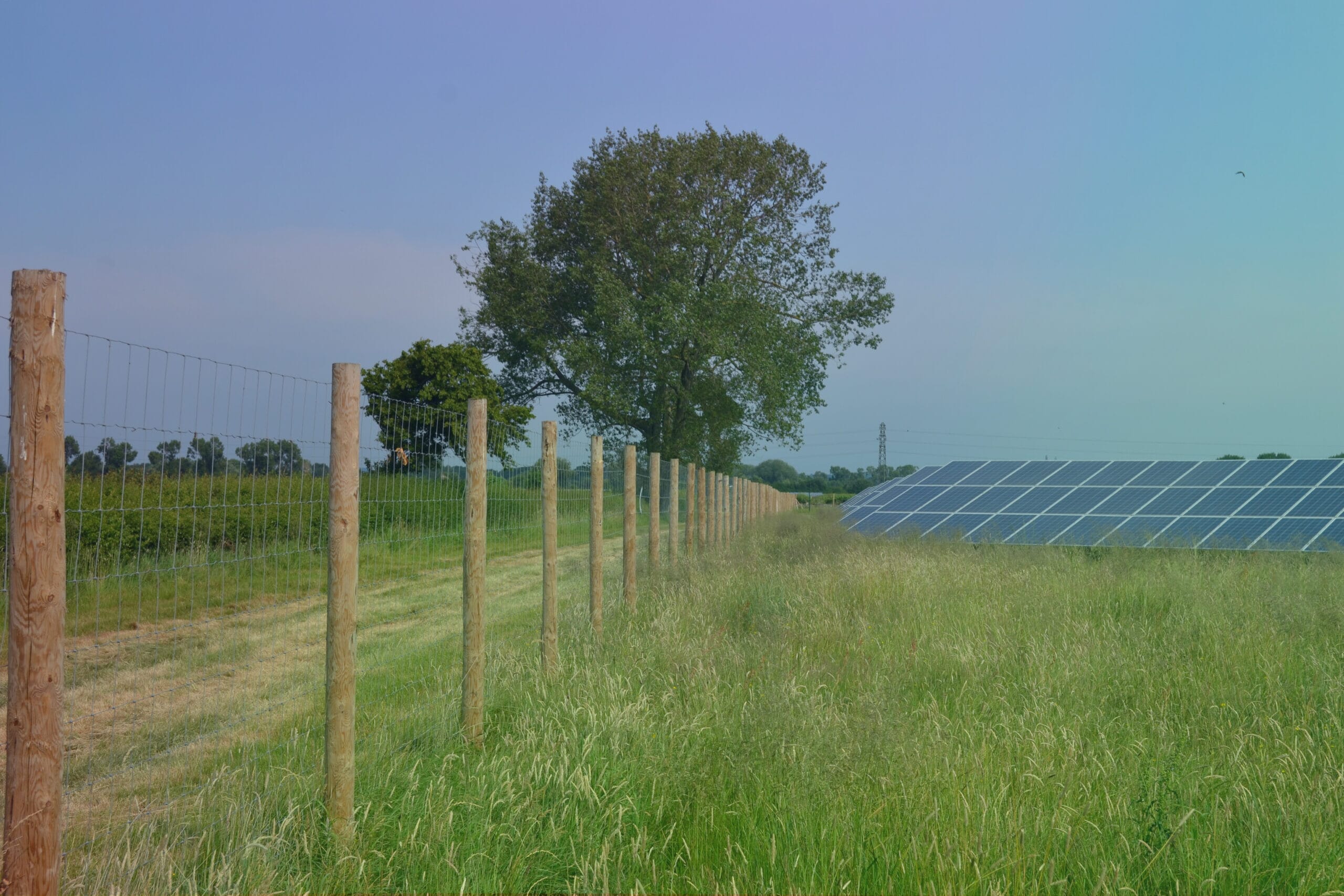
Landscape and Visual: The site extends across two fields, which benefit from existing landscape screening within an extensive network of bounding hedges and woodland. We will enhance and reinforce this existing screening. A Landscape and Visual Impact Assessment informed the landscape strategy and was included in the planning application

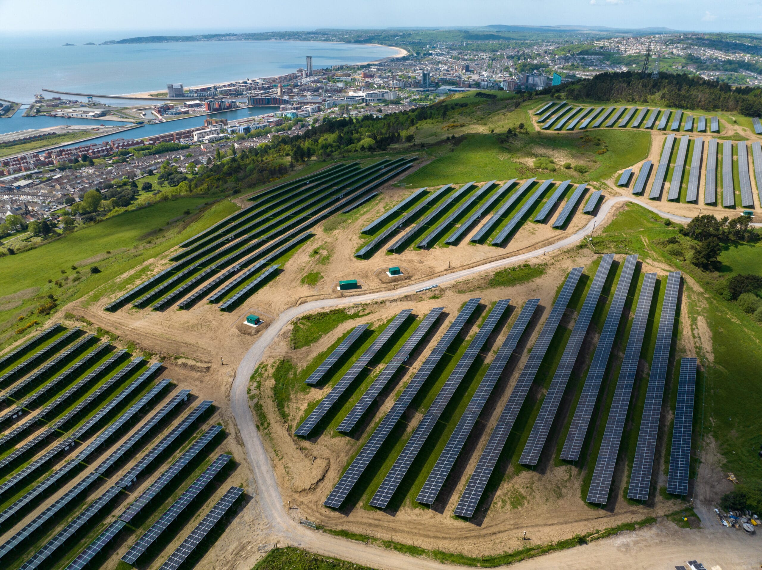
Agricultural Land Quality: We have undertaken a site-specific agricultural land classification survey, which confirms that the land is classified as Grade 3b. Therefore, the site is not classed as ‘best and most versatile’ agricultural land (Grade 1 to 3a).

Cultural Heritage and Archaeology: We have undertaken a Historic Environment Desk-Based Assessment of the local designated and non-designated heritage assets and considered the potential for non-designated archaeology.  Following this assessment, a geophysical survey was completed across the site to confirm any potential archaeological remains. The outcome of this survey has informed the site layout.

Ecology: Ecology surveys were completed and an Ecological Impact Assessment prepared to ensure existing habitats are enhanced and new habitats created to the benefit of local wildlife.  A Landscape and Ecology Management Plan details how the on-site habitats are to be managed and maintained for the duration of the project.

Hydrology: The site is located within Flood Zone 1, the area recognised by the Environment Agency as having the lowest probability of flooding. A flood risk assessment and sustainable drainage strategy were included in the planning application.

Glint and Glare: We undertook a Glint and Glare Assessment, which assessed road safety, residential amenity, and aviation activities associated with RAF Fairford, Calcot Peak Airfield, and South Cerney Airfield. The assessment found:

  • no significant impacts are predicted upon road safety, residential amenity and upon aviation activity associated with Calcot Peak Airfield and South Cerney Airfield
  • no impacts predicted upon aviation activity associated with RAF Fairford

Frequently Asked Questions

What will the construction traffic route be?

Construction traffic will route from the site towards the Sunhill junction, before heading due south and joining the A417. This route has been agreed with Gloucestershire County Council highways authority.. Construction traffic will not travel through Fairford town. This will be set out within the Construction Traffic Management Plan.

How will the solar farm impact food security?

An Agricultural Land Classification survey has been completed, and the land has been determined not to be best and most versatile (BMV). The land used for the solar farm forms only part of the landowners available farming land. The proposal also includes planting, which will form suitable grazing land for sheep, therefore enabling a dual use of the site and continuation of its agricultural use.

Why does the site need to be located here?

The positioning of a solar site is dependent on several aspects, primarily grid connection and land availability. Our initial approach is to review brownfield sites, however, these need to be within a viable distance from the available point of connection. Due to the location of this point of connection, greenfield development is required to deliver a viable development.